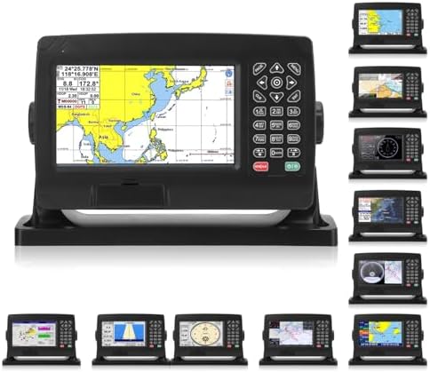
ariarly Marine Navigation GPS Plotter GPS Chart Plotter Satellite Navigator Transponder with GNSS Antenna Dual Map System IPX6 for Marine Boat




As an Amazon Associate we earn from qualifying purchases.
Product Overview
Key features
Precise Positioning: GNSS chart plotter supports BDS, GPS dual mode positioning, combined with self developed SOG and COG filtering algorithm, high receiving sensitivity, accurate position., Dual Chart System: Support for C MAP MAX and for XINUO MAP dual chart system, users can switch independently. Built in global charts, providing regular updates of XIUO charts., Large Capacity Storage: Using a high speed and stable flash chip, the device supports storage of 50,000 waypoints, 50,000 mark points, 500 routes, 1,000 tracks, and 1.6 million track points., Custom Settings: Support to display your own ship at any position on the screen to expand the navigation field.
Also supports custom data names, symbol styles and colors., Rainproof Shell Design: Plastic shell design, rainproof, dust proof, anti interference, fast heat dissipation. The water and dust proof grade is IPX6..
Key Points
What makes this product stand out
Related Deals
Similar Products
Frequently Bought Together
Never Miss a Deal
Get the best discounts and expert picks delivered to your inbox.
Join thousands of smart shoppers
